573 YouTube Flying Videos by Jan
Nademlejnsky
>> HOME
<<
July 7, 2026
I 2026 I 2025
| 2024 | 2023
| 2022 | 2021 | 2020 | 2019 | 2018 | 2017 | 2016 | 2015 | 2014 | 2013 | 2012 | 1974-2010
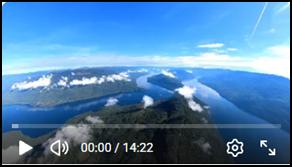
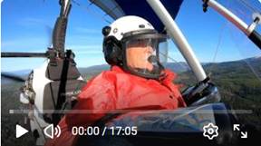
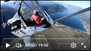
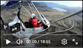
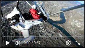
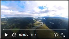 573. Flight to Little Fort and Forced to Return
Due to Rain on My Planned Route, Jul 3, 2026
573. Flight to Little Fort and Forced to Return
Due to Rain on My Planned Route, Jul 3, 2026
Excellent
flight to the Little Fort area, though I was forced to return due to rain on my
planned route west. The area south of Little Fort is visually unique,
especially this day with several layers of cloud stacked overhead. It looked
almost like flying over the
Photos
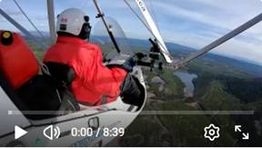
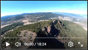
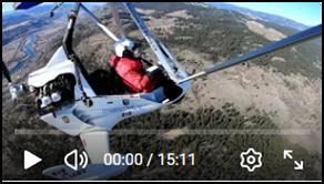
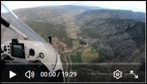 572. Adventure Flight through the
rugged Nicola River Valley to Ashcroft via Merritt, Jun 23, 2026
572. Adventure Flight through the
rugged Nicola River Valley to Ashcroft via Merritt, Jun 23, 2026
It was a perfect day for exploring new
places from the air. The first leg carried me through the always beautiful
The gentle countryside soon gave way
to the raw, dramatic nature of a narrow and deeply cut valley without any still
naturally green areas. The east slopes sat in heavy shadow while the west
slopes warmed in the sun, a combination that can easily spark turbulence.
Several converging valleys met in complex junctions that offered little
reassurance doe to possibility of seriously confusing air flows. Even so, the
weather held, and the flying conditions were nearly perfect.
The experience is difficult to
capture in words. I may well be the first to document these low‑level
aerial views of this region. I passed over
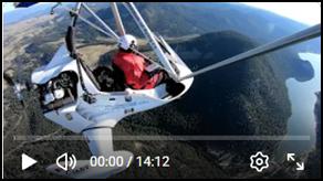
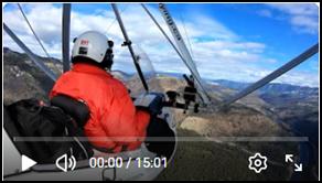
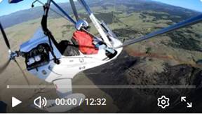 571. Very Turbulent Flight to Check the Results of the Stump Lake Area
Fire. Jun 18, 2026
571. Very Turbulent Flight to Check the Results of the Stump Lake Area
Fire. Jun 18, 2026
I flew out to assess the fire damage shortly after the crews extinguished it. This area is normally stunning, especially now with everything so green and full of life. I took off early hoping to avoid turbulence, but the air was rough and twice I was lifted from my seat by sudden jolts. From the air the burn zone looks small, though the water bombers worked for hours to contain it. You could clearly see how close it came to the nearby homes.
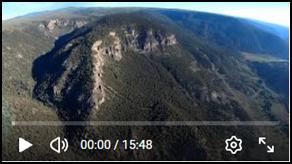
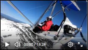
 570. Excellent Northern
Clearwater and Raft Mountain Flight with Exceptional Scenery. Jun 13, 2026
570. Excellent Northern
Clearwater and Raft Mountain Flight with Exceptional Scenery. Jun 13, 2026
The
Ground visibility was challenging
because of the early morning deep shadows on the west-facing slopes contrasting
with the bright light on the opposite side. Both my eyes and the cameras
struggled to capture the scenery hidden in those dark canyons.
On my way back south, I noticed a
well‑snow‑covered peak on the east side. I decided to fly toward it
for a closer look. This became the highlight of the entire flight: seeing
I turned home with better sun
conditions, which made it easier to appreciate the landscape on the return leg.
It was a superb flight.
 569. Morning Flight to Deadman
Falls via Tobiano, Savona, Deadman River Valley, Jun 8, 2026
569. Morning Flight to Deadman
Falls via Tobiano, Savona, Deadman River Valley, Jun 8, 2026
Adventurous flight to Deadman Falls covering
155 km (96 mi) of very complex terrain with deep valleys, high ridges, and many
lakes. The first leg was more or less in a north–south direction, which helped
avoid direct sunlight in my face. Flying in and above the deep valley brought
another challenge: the dark, cold shade on the east slopes and the already
heated sunny slopes on the opposite side. It was a perfect setup for strong
turbulence.
It was a very good and cold flight, but not a
relaxing one. Turbulence and strong wind flows kept me vigilant, always
anticipating any potentially dangerous downdrafts.
 568. Exploring Huge Areas of Shuswap Lake,
Armstrong, Salmon Arm, Sicamous, Jun 2, 2026, Part 2 of 2
568. Exploring Huge Areas of Shuswap Lake,
Armstrong, Salmon Arm, Sicamous, Jun 2, 2026, Part 2 of 2
My video #566 shows the north
Key points along the route shown in
video # 567 (part 1 of 2) included Buse Hill, Monte Lake, Westwold, Falkland,
Armstrong, and a landing in Salmon Arm to top up my fuel. The countryside is
absolutely incredible.
This video (Part 2 of 2) covers
Salmon Arm, Salmon River, Rosemond Lake, Mara Lake, highlights of Sicamous, the
houseboat Mecca, the northeast section of Shuswap Lake, and the north shore
with all its attractions below. I continued to Squilax by Little Shuswap Lake,
then to
I covered
309 km (192 mi), which was my longest flight so far and the longest stretch of
pure fun. The weather was almost perfect with calm flying most of the time.
Photos
 567. Exploring Huge Areas of Shuswap Lake,
Armstrong, Salmon Arm, Sicamous, Jun 2, 2026, Part 1 of 2
567. Exploring Huge Areas of Shuswap Lake,
Armstrong, Salmon Arm, Sicamous, Jun 2, 2026, Part 1 of 2
My previous video #566 shows the
north
Key points along the route included
Buse Hill,
My next video #568 (Part 2 of 2)
covers Salmon Arm, Salmon River, Rosemond Lake, Mara Lake, highlights of
Sicamous, the houseboat Mecca, the northeast section of Shuswap Lake, and the
north shore with all its attractions below. I continued to Squilax by Little
Shuswap Lake, then to
I covered 309 km (192 mi), which was
my longest flight so far and the longest stretch of pure fun. The weather was
almost perfect with calm flying most of the time.
 566. Record Flight to NE Shuswap
Lake, Sicamous, Mara Lake, Salmon Arm, Chase .., May 28, 2026
566. Record Flight to NE Shuswap
Lake, Sicamous, Mara Lake, Salmon Arm, Chase .., May 28, 2026
A flying milestone today. I traced
282 km (175 mi) from Kamloops to the Shuswap Lake region, following the north
shore before looping south through Sicamous, Salmon Arm, and Chase. After three
failed attempts, the nature finally opened the door for this adventure. The
eastbound leg came with harsh morning sun and sharp reflections off the water,
but everything beyond that felt like a reward. The landscape was bright and
green, the air calm, and the whole scene almost festive. A super fun flight.
Photos
 565. A Challenging Flight across
the Complex Terrain surrounding Adams Lake. May 21, 2026
565. A Challenging Flight across
the Complex Terrain surrounding Adams Lake. May 21, 2026
It was an adventure of adventures,
one that will stay with me for a long time. I was surprised by the terrain complexity
and by the high mountain ridges still fully covered with snow. The main
features were Barriere,
 564. Turbulent Flight to Paul Lake, Shuswap
Lake, Chase and South Thompson River May 4, 2026
564. Turbulent Flight to Paul Lake, Shuswap
Lake, Chase and South Thompson River May 4, 2026
My original ambitious route was cut short due to persistent
turbulence.. I still managed to capture the quickly awakening spring landscape
in the surrounding countryside
 563. Adventure Flight
via Merritt to Mt Vicuna, Unique Natural Formations, May 1, 2026. 1 of 2
563. Adventure Flight
via Merritt to Mt Vicuna, Unique Natural Formations, May 1, 2026. 1 of 2
This
video captures the first part of my nonstop 200 km (124 mi) adventure flight to
 562. Vicuna Peaks
Return Flight from Merritt Airport, May 1, 2026, Part 2 of 2
562. Vicuna Peaks
Return Flight from Merritt Airport, May 1, 2026, Part 2 of 2
On the return leg from
 561. Flight via Turbulent Northern Rd to Paul
Lake, Chase and South Thompson River Apr 27, 2026
561. Flight via Turbulent Northern Rd to Paul
Lake, Chase and South Thompson River Apr 27, 2026
My original ambitious flight plan was cut short by
unexpected and unpleasant turbulence. I still managed to capture the quickly
awakening spring landscape in the surrounding countryside.
 560. Flight to Martin Mt, Salmon Arm,
Scotch Creek Area, Chase, Paul Lake and other. Apr 20, 2026
560. Flight to Martin Mt, Salmon Arm,
Scotch Creek Area, Chase, Paul Lake and other. Apr 20, 2026
Truly the flight of flights, combining spectacular scenery
with exceptional flying conditions.
Photos
 559. Scenic Flight to
Buse Hill, Campbell Creek Rd, Knutsford Region, Downtown… Kamloops Apr 8, 2026
559. Scenic Flight to
Buse Hill, Campbell Creek Rd, Knutsford Region, Downtown… Kamloops Apr 8, 2026
A beautiful
flight across some of the finest scenery in the
Photos
 558. Scenic Flight to Sun Peaks via Barriere. Apr 4, 2026
A perfect
day for flying and checking the season end at
Photos
 557. Flight to Wild Areas of
Tranquille and Saul Lakes. Apr 3, 2026
557. Flight to Wild Areas of
Tranquille and Saul Lakes. Apr 3, 2026
It was a
psychologically challenging flight into the very remote country around
Photos
 556. Thompson River Valley to Cache Creek via
Tobiano, Savona, Walhachin… Mar 24 2026
556. Thompson River Valley to Cache Creek via
Tobiano, Savona, Walhachin… Mar 24 2026
After three long weeks of unsettled
weather, the sky finally opened into an almost perfect flying day. I set out on
a 155 km scenic flight to Cache Creek, following the winding beauty of the
I circled the Cache Creek airport to
consider a landing, but the conditions felt off, so I let the idea go and
carried on. The Thompson Estate area has always fascinated me. Along the north
bank, the river has carved sweeping curves into a steep, clean angle of repose
that looks as if it were shaped by human hands. It is a rare and striking
formation.
I also made passes over the Tobiano
golf and residential area, enjoying its patterns from above, along with the
natural formations on the southwest side. The entire flight was deeply
enjoyable.
Photos
 555. South Thompson Valley Flight to the Back Door of Sun Peaks. Mar 1, 2026
Excellent
spring-like weather could not be wasted, so I had to go flying. I followed the
always beautiful
 554. Scenic North Thompson Valley Flight from Kamloops to
Barriere and Back. February 24, 2026
554. Scenic North Thompson Valley Flight from Kamloops to
Barriere and Back. February 24, 2026
It’s
always a pleasure to fly above the
 553. Stunning Views,
Rough Ride: Flying Lac Le Jeune, Brigade Lake, Knutsford and Downtown. Kamloops Feb 12, 2026
553. Stunning Views,
Rough Ride: Flying Lac Le Jeune, Brigade Lake, Knutsford and Downtown. Kamloops Feb 12, 2026
It’s
always a pleasure to fly above the
 552. Turbulent Flight in South Thompson Valley and NW Ridge.
Kamloops Feb 6, 2026
552. Turbulent Flight in South Thompson Valley and NW Ridge.
Kamloops Feb 6, 2026
My 79th
birthday flight carried me along the
 551.
Perfect Flight to Sun Peaks Ski Resort and Paul Lake Area.
January 16, 2026
551.
Perfect Flight to Sun Peaks Ski Resort and Paul Lake Area.
January 16, 2026
It
was one of my best flying days ever, with a perfectly blue sky and no turbulent
air. The aerial views were spectacular and captured the natural beauty of the
 550.
Kamloops North Ridge, Unpleasant Turbulence. Jan 14, 2026
550.
Kamloops North Ridge, Unpleasant Turbulence. Jan 14, 2026
Nature’s
winning 4 - 2. Four rough turbulence hits in my last six flights. It was bad
again. My original plan to fly to
With
no wind and no temperature differences, why is there turbulence? Here is why:
Mechanical
turbulence that lingers
Even
with no current wind at the surface, earlier winds can leave behind uneven pockets
of air, especially around terrain like the hills and ridges around
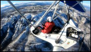 549: Perfect Flight to Savona Mt,
Tobiano, Cherry Creek, Kamloops DT. January 5, 2026
549: Perfect Flight to Savona Mt,
Tobiano, Cherry Creek, Kamloops DT. January 5, 2026
At
last, a nearly perfect day for flying, and it truly paid off. I loved this
flight. I followed the south shore of
The video highlights Cherry Creek, Tobiano
dramatic valleys and steep slopes, the north side of
 548. Beautiful Flight in NW Kamloops.
January 2, 2026
548. Beautiful Flight in NW Kamloops.
January 2, 2026
I was losing confidence in the weather after three straight flights through heavy turbulence. This day looked no different from the others — the forecast, the sky, the wind all repeating themselves — and it made me uneasy. But in the end, the air surprised me, and the flight turned into something I genuinely enjoyed.
I
followed the North Thompson River up toward Heffley Creek, drifted back south,
and swung west across the North Ridge. From there I turned south again,
crossing