547 YouTube Flying Videos by Jan
Nademlejnsky
>> HOME
<<
January 22, 2026
| 2026 | 2025 | 2024 | 2023
| 2022 | 2021 | 2020 | 2019 | 2018 | 2017 | 2016 | 2015 | 2014 | 2013 | 2012 | 1974-2010
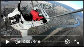
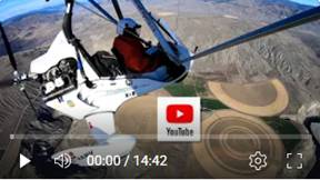
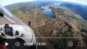
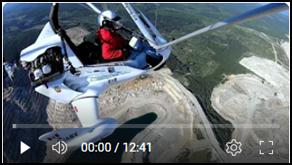
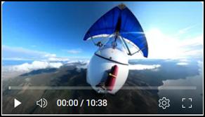
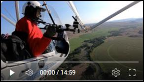
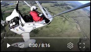
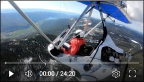
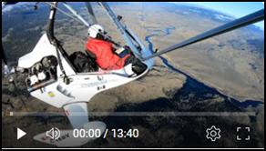
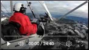
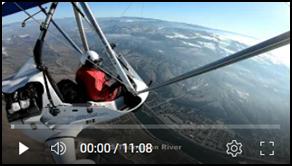
 547. Kamloops
Lake, Extreme Turbulence North of Savona, Dec 31, 2025
547. Kamloops
Lake, Extreme Turbulence North of Savona, Dec 31, 2025
This was my third consecutive flight in heavy turbulence. Come on, weather. It’s winter, and it’s supposed to offer better flying conditions than the summer heat. There was nothing obvious to suggest this would happen. The ground wind was very light and steady, and there were no strong contrasts between sunny and shaded areas.
I had
originally planned to fly over the ski hills to check the snow conditions. I
didn’t make it far before the first bursts of intense turbulence reminded me
who was in charge. I was forced to change my flight plan, shifting from the
northeast to the southwest toward
I decided
to cut the flight short when the turbulence became more intense. I turned west
of Tobiano toward the north side of
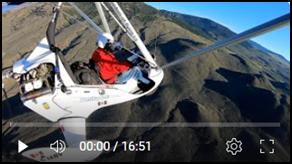
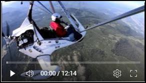
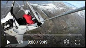
 546. Short and Turbulent Flight around Lower Kamloops, Dec 19, 2025
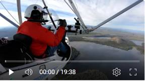
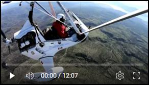
 545. Short and Turbulent Flight around Kamloops,
Dec 9, 2025
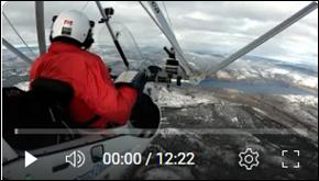
545. Short and Turbulent Flight around Kamloops,
Dec 9, 2025
What began
as a peaceful flight soon became my first encounter with Wavy Winds. Our meteorologist explained
this rare phenomenon: vertical columns of air shaped by high winds rolling in
waves from the day before. The turbulence was rough but manageable—until 2:39,
when a sudden jolt lifted me against the seat belt. It was over in an instant,
like a strike from nowhere, before settling back into the usual bumps.
Reviewing four camera angles in slow motion offered no answers. It was both
frightening and fascinating, a reminder of how unpredictable the skies can be.
The photos at the end of the video (captured approximately two hours after my
flight) reveal cloud formations in distinct wave patterns, caused by the Wavy
Winds.
Photos
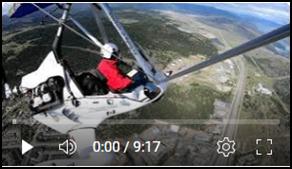
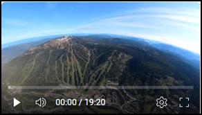
 544: Winter Flight to Sun Peaks
and Harper Mountain Ski Resorts. Kamloops, November 23, 2025
544: Winter Flight to Sun Peaks
and Harper Mountain Ski Resorts. Kamloops, November 23, 2025
It was a
cold, crisp, and calm day that urged me to go flying. I decided to check our
ski resort, which was supposed to open two days earlier, but there wasn’t
enough snow to make it happen. The light and flying conditions were almost
perfect for capturing video, with diverse nature all around me and fascinating
clouds above.
Photos
 543. Clouds over Kamloops: A Brief Scenic
Flight, November 17, 2025
543. Clouds over Kamloops: A Brief Scenic
Flight, November 17, 2025
Back in the air after two weeks off for a disk brake replacement. Morning weather was variable, with light rain on the drive to the airport—a real risk for my five external cameras and exposed electronics. The flight turned out great, with striking cloud patterns and sunlight breaking through. This region is stunning, never boring to watch, especially from above. Happy to share the experience with you.
Photos
 542. Flight to Cache Creek and
Ashcroft in Spectacular River Valley: Kamloops Oct 27, 2025
542. Flight to Cache Creek and
Ashcroft in Spectacular River Valley: Kamloops Oct 27, 2025
I took
advantage of ideal flying conditions to explore the region. My route included
Cherry Creek, Tobiano,
Photos
 541. Flight over Martin Mt and Paul Lake: Calm
and Turbulent Conditions. Kamloops Oct 21, 2025
541. Flight over Martin Mt and Paul Lake: Calm
and Turbulent Conditions. Kamloops Oct 21, 2025
It was a
beautiful and fascinating flight through highly variable flying conditions —
ranging from completely calm to wild and turbulent. I had to change my flight
plan twice because of the shifting weather. I explored Mt.
Photos.
 540. Beautiful Flight to Greenstone Mt, Face and
Paska Lakes and other Places, Kamloops , Oct 14, 2025
540. Beautiful Flight to Greenstone Mt, Face and
Paska Lakes and other Places, Kamloops , Oct 14, 2025
100 km of
airborne joy, tracing the contours of
Photos
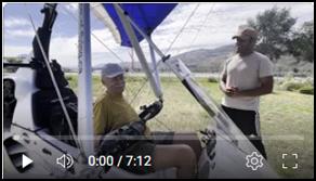 539. I am being Interviewed about my Trike.
Kamloops Airport, July 7, 2025
539. I am being Interviewed about my Trike.
Kamloops Airport, July 7, 2025
Short interview by Ishan Tewari about features on my trike
 538. Beautiful and Adventures Fall
Flight to Adams Lake, Oct 3, 2025
538. Beautiful and Adventures Fall
Flight to Adams Lake, Oct 3, 2025
This
marked my third attempt to explore
Though
stunning, the area is deeply intimidating to fly through.
At the 35
km mark, I turned west toward another BC gem:
Photos
 537. Flying to Tobiano and Savona, Sep
25, 2025
537. Flying to Tobiano and Savona, Sep
25, 2025
I had to
change my flight plan in mid-flight twice due to unfavorable flying conditions,
but ultimately it was another 150 km of fun flight. The video shows details of
the unique Tobiano Residential & Golf Course, which was ranked #90 on Golf
Digest’s list of the World’s 100 Greatest Golf Courses in 2022
Photos
 536. Flying over North Thompson
River to East Barriere Lake. Aug 28,
2025
536. Flying over North Thompson
River to East Barriere Lake. Aug 28,
2025
The
original plan was much more ambitious. I intended to fly the entire length over
Photos
 535. Flying to Douglas and Many Other
Lakes via Monte Lake. Aug 21, 2025
535. Flying to Douglas and Many Other
Lakes via Monte Lake. Aug 21, 2025
A 196 km flight through breathtaking natural landscapes,
showcasing a diverse range of terrains. This journey offers inspiration for
exploring new destinations and deepening your knowledge of local areas—all
while immersing yourself in raw, untouched nature.
Photos
 534. Flying to Chase and Little Shuswap Lake Via
Niskonlith and Aylmer Lakes. Aug 8, 2025
534. Flying to Chase and Little Shuswap Lake Via
Niskonlith and Aylmer Lakes. Aug 8, 2025
This was
an early morning flight over the most beautiful part of the region. The video
quickly skips through the eastern leg, which was recorded in direct, low-level
morning sunlight. I turned slightly northeast toward Niskonlith and
Photos
 533. Flying from Merritt to Highland Valley
Copper Mine Via Mamit Lake. Part 2 of 2,
Aug 3, 25
533. Flying from Merritt to Highland Valley
Copper Mine Via Mamit Lake. Part 2 of 2,
Aug 3, 25
This is
the second leg of my 230 km (143 mi) flight to the Highland Valley Copper Mine.
The video offers a truly unique aerial perspective of the largest open-pit
copper mine in
After
exploring the mine, I continued on to the Tunkwa and
 532. Flying to Merritt Via Lac Le Jeune and
Nicola Lake. Part 1 of 2, Aug 3, 25
532. Flying to Merritt Via Lac Le Jeune and
Nicola Lake. Part 1 of 2, Aug 3, 25
This is
the first leg of my 230 km (143 mi) flight to the Highland Valley Copper Mine.
I landed at the small municipal airport in Merritt, having crossed several
lakes along the way, each clearly labeled. It was a thoroughly enjoyable
flight—the surrounding nature is consistently phenomenal.
Photos
 531. Flying to Lac Le Jeune,
Trapp, Shumway, Pinantan and Paul Lakes via Barnhartvale Jul 31, 2025
531. Flying to Lac Le Jeune,
Trapp, Shumway, Pinantan and Paul Lakes via Barnhartvale Jul 31, 2025
I had to
change my flight plan midway due to rain in the area. Instead of flying southwest,
I headed northeast. Fortunately, this region is so breathtaking that I’ll never
run out of interesting places to explore from the air.
On this
flight, I’m highlighting the following features: Insk, McConnell, Stake, Lac le
Jeune, Ridge, Napier, Richie, Trapp, Shumway, Pinantan, Paul and
Photos.
 530.
Flying to Red, Hihium and Loon Lakes,
Clinton, Cache Creek and Savona. July 24, 2025
530.
Flying to Red, Hihium and Loon Lakes,
Clinton, Cache Creek and Savona. July 24, 2025
An epic 225 km (140 mi) adventure deep into raw nature. I expanded
my aerial explorations further northwest, reaching the foothills of the Coastal
Mountain Range. The spectacular scenery continued to amaze me with its untamed
natural beauty.
 529. Kamloops Area In
Beautifully Sculptured Clouds. July 20, 2025
529. Kamloops Area In
Beautifully Sculptured Clouds. July 20, 2025
After two weeks of beautiful—but
unflyable—weather, I finally got lucky. The forecast was still not very
convincing, but I felt it in my bones: this was the moment. And I was right.
It was the first time in my life
experiencing such a complex, multi-layered sky. My original plan was to embark
on a cross-country flight, but once I gained sufficient altitude, I saw the
towering, heavy clouds guarding the horizon like gatekeepers. I decided to stay
local—and it turned out to be a fantastic flight.
The camera footage is spectacular,
especially when viewed on a large screen.
 528. Flying
over many Lakes South of Bonaparte Lake. July 7, 2025
528. Flying
over many Lakes South of Bonaparte Lake. July 7, 2025
Another adventure exploring
a vast area dotted with numerous lakes and a fascinating feature between
Bonaparte and
 527. 225
km Super Adventure: Exploring Bonaparte Lake Area, Deadman’s Falls &
Valley. July 2, 2025
527. 225
km Super Adventure: Exploring Bonaparte Lake Area, Deadman’s Falls &
Valley. July 2, 2025
Finally, the third attempt at this flight was successful. I had to abandon my previous try midair due to weather. Even after so many flights, I’m still amazed by the fascinating places tucked into this region’s diverse natural beauty. So many lakes lie in remote, hard-to-reach areas—yet somehow, people have found ways to live and thrive among them.
The east-west leg of this journey
was a bit intimidating, with the ever-present potential for sudden weather
changes that could turn things miserable—but not this time. After passing over
the vast
That area has undergone a dramatic
transformation. Once dense forest, it was reduced to near-barren land by the
devastating wildfire in 2021. I visited the falls twice on motorcycle: first on
April
21, 2021—before the fire—and again on October 3, 2023, after
the blaze. The falls, and especially the canyon’s unguarded edges, look far more
intimidating from the ground than they do from the air.
Three-quarters of the trip was
relaxing, until I hit some serious turbulence in the canyon. Thankfully, it
didn’t last long. The
 526.
A Breathtaking Aerial
Perspective of Kamloops and its Diverse Landscape. Jun 26, 2025
526.
A Breathtaking Aerial
Perspective of Kamloops and its Diverse Landscape. Jun 26, 2025
My original flight plan was for a much longer journey, but
weather conditions forced me to change course. This shorter flight video
captures the spectacular and diverse landscape around
Photos
 525.
Flying 220 km over
Salmon, Chapperon, Douglas, Peter Hope, Stump and other Lakes, June 16, 2025
525.
Flying 220 km over
Salmon, Chapperon, Douglas, Peter Hope, Stump and other Lakes, June 16, 2025
Excellent and beautiful
flying conditions made for some serious fun. The 220 kilometers I covered
showcase incredibly diverse and spectacular landscapes. Douglas Lake Ranch is a
truly beautiful spot—built into a small village, complete with a church and
many red-roofed buildings that stand out sharply against the lush green
surroundings.
 524. Flying to 3 Airports: My Record Journey over
Breathtaking Landscapes. Part 2 of 2, June 11, 2025
524. Flying to 3 Airports: My Record Journey over
Breathtaking Landscapes. Part 2 of 2, June 11, 2025
This is the second part of my previous video #523. I continued
from Armstrong to Hullcar Hill and
I landed at Salmon Arm (YSA) Airport
for a quick pit stop but chose to skip an invitation to join the local flying
club for coffee—I didn’t want to risk losing my ideal flying conditions. The
weather and turbulence in this region can change rapidly, and I still had 100
km (62 mi) left on my return journey to
I flew in a straight line to Pinantan
and
 523. Flying to 3 Airports: My Record
Journey over Breathtaking Landscapes. Part 1 of 2, June 11, 2025
523. Flying to 3 Airports: My Record
Journey over Breathtaking Landscapes. Part 1 of 2, June 11, 2025
This is my longest flight and my first
time flying to three airports. I split the video into two parts. Part 1 of 2
covers the first 150 km (93 mi) of the flight from
The meadows and farm fields around Armstrong were a big
change from the terrain I usually face in
 522. Scenic Flight Over Thompson
Rivers: Monitoring Water Levels, June 2, 2025
522. Scenic Flight Over Thompson
Rivers: Monitoring Water Levels, June 2, 2025
I took an exceptional nature flight
over the North and
My flight path led me upstream along
the North Thompson River to Barriere, then over the
Although strong winds and mountain
turbulence made for a less-than-relaxing experience, the journey through the
lush, unusually green landscape was breathtaking. Despite the challenges, it
was an outstanding flight, offering both adventure and a valuable opportunity
to observe nature’s seasonal rhythms.
 521.
Planned Adventure Spoiled by Persistent
Turbulence, May 23, 2025
521.
Planned Adventure Spoiled by Persistent
Turbulence, May 23, 2025
This was a short flight (and without
music), just a fraction of my original 275 km adventure. The forecasted flying
conditions were supposed to be ideal, but reality was the complete opposite. I
knew right away at the gate that it wouldn’t be a pleasurable or fun flight.
The weather was already warm, and I was getting hot in my winter gear.
The air quickly became turbulent
with serious jolts of updrafts. There were no clouds above to suggest these
conditions, yet the ride was rough. I called it quits—definitely the right
decision, as another pilot who flew an hour after me reported, “Bumpy as hell,
crowding my comfort level. Still, I managed to squeeze in my 20-minute fun fix,
which was good.
 520. My
Top-Rated Challenging Flight at 3,406 m (11,175 ft) over Dunn Peak. Barriere,
May 15, 2025
520. My
Top-Rated Challenging Flight at 3,406 m (11,175 ft) over Dunn Peak. Barriere,
May 15, 2025
This flight
was the ultimate high-performance challenge—an adventure that felt like
standing atop
 519. Flight over Roche, Palmer Meadows and other
Lakes. Kamloops, May 11, 2025
519. Flight over Roche, Palmer Meadows and other
Lakes. Kamloops, May 11, 2025
I took an interesting
flight over Roche and other beautiful lakes a couple of days after my
introductory motorcycle trip there. I also explored the grounds of Birken
Monastery. Noted lakes in this video: Separation, Shumway, Roche, John Frank,
Frisken, beautiful and interesting Palmer Meadows, and Horseshoe.
 518. After Season Flight to Sun Peaks Ski
Resort, Kamloops, Apr 30, 2025
518. After Season Flight to Sun Peaks Ski
Resort, Kamloops, Apr 30, 2025
This is a
stunning time of year in this arid region. The landscape has transformed, with
lush greenery and bursts of vibrant yellow flowers dotting the terrain. I set
out earlier, eager to fly to
 517.
Excellent Round Flight to Salmon Arm,
Via Mt Ida and Chase Back to Kamloops, Apr 23, 2025
517.
Excellent Round Flight to Salmon Arm,
Via Mt Ida and Chase Back to Kamloops, Apr 23, 2025
230 km (143 mi) of mostly fun—with two powerful wake-up
calls from nature reminding me who's boss! Stunning views and exhilarating
countryside along the way.
 516. Adventure Flight across a Series
of Lakes, Showcasing the Beauty of Douglas Lake and Beyond. Kamloops Apr 13,
2025
516. Adventure Flight across a Series
of Lakes, Showcasing the Beauty of Douglas Lake and Beyond. Kamloops Apr 13,
2025
A beautiful
flight to the charming countryside nestled behind many hills. It’s also an
ideal place for a scenic drive, with perfect roads and picturesque natural surroundings.
This video features several lakes, including McConnell, Stake, Lac le Jeune,
Fred, Ross Moore, Stump,
 515.
Return Flight from Merritt Via
Mamit & Logan Lakes. Merritt
Apr 4, 2025
515.
Return Flight from Merritt Via
Mamit & Logan Lakes. Merritt
Apr 4, 2025
A short stop at the sunny Merritt airport, after a cold
flight from
 514.
Fantastic Flight Via
Nicola Valley to Merritt Airport. Kamloops Apr 4, 2025
514.
Fantastic Flight Via
Nicola Valley to Merritt Airport. Kamloops Apr 4, 2025
This is one of the most scenic trips while traveling on
Highway 5A through
 513.
Flight NW of Mt
Savona and Tobiano. Kamloops Mar 29, 2025
513.
Flight NW of Mt
Savona and Tobiano. Kamloops Mar 29, 2025
Another remarkable flight showcasing
the exceptional natural beauty surrounding us. Fully appreciate the
breathtaking views from above, complementing your experience from the ground
up. A detailed look at the Tobiano Golf and Residential area highlights its
distinctive and unique topography.
 512. Flight to Duffy and Tunkwa Lakes, Mt Savona
and Tobiano. Kamloops Mar 22, 2025
512. Flight to Duffy and Tunkwa Lakes, Mt Savona
and Tobiano. Kamloops Mar 22, 2025
Another beautiful day and a flight
to the lesser-known
 511. Spectacular Flight to Walhachin
Area. Kamloops Mar 14, 2025
511. Spectacular Flight to Walhachin
Area. Kamloops Mar 14, 2025
The
flight into the intriguing geological formations of the Walhachin area was
nothing short of spectacular. Initially, the sky was completely gray, but it
suddenly cleared around the airport, signaling the perfect opportunity to take
to the skies. While the journey began with a few bumps, the conditions
eventually became manageable.
I
navigated cautiously, keeping a watchful eye on the intimidating bands of
clouds flanking both sides of
 510.
The Shortest Flight
and the Worst Take off Turbulence. Kamloops Mar 6, 2025
510.
The Shortest Flight
and the Worst Take off Turbulence. Kamloops Mar 6, 2025
The
weather forecast and actual conditions appeared excellent, but reality turned out
to be the complete opposite. A cold gale hit me from the side—twice—sudden and
unexpected, while I was still accelerating on the ground. I knew right away
that this flight was going to be interesting.
The
air turbulence was severe just above the ground and continued to intensify. I
looked around but couldn't find any reason for what was happening, nor any
indication it would improve with time. Before reaching the western threshold of
the runway, I decided not to push my luck and turned back for home.
The landing was tough. The back
wheels touched down on the pavement while the front wheel was still hovering
just above the ground. Suddenly, a crosswind burst hit. The front wheel landed
slightly at an angle, which triggered the trike infamous “Duck Walk.” My large
Lexan windshield split vertically down the center into two pieces. I needed to
replace the windshield anyway, as it had too many scratches causing star
reflections in bright sunlight or snow. It was really interesting flight, but
no fun this time
 509.
Exploring Paul Lake
Area, S Thompson River and Kamloops City. Feb 28, 2025
509.
Exploring Paul Lake
Area, S Thompson River and Kamloops City. Feb 28, 2025
This
was one of the best flights of my life. Perfect flying conditions and
breathtaking nature made my day unforgettable. I passed over Harper Ski Hill
and made two loops above
From
there, I ventured off the beaten path, exploring several areas before arriving
in Pritchard. This marked the start of my most popular flying corridor as I
headed back toward
Finally,
I soared above
 508.
Exploring the Most
Beautiful Nature Area in Kamloops: NW Ridge, Battle Bluff, Frederick,
Viewpoints and Hiking Trails, Kamloops,
Feb 23, 2025
508.
Exploring the Most
Beautiful Nature Area in Kamloops: NW Ridge, Battle Bluff, Frederick,
Viewpoints and Hiking Trails, Kamloops,
Feb 23, 2025
I had to change my plan just a few minutes after takeoff due
to sudden and serious turbulence, which gave me quite a workout. Eventually, I
ended up exploring the beautiful NW Ridge area. It is popular with both leisure
and serious hikers. Check out how it looks from the air!
Pictures
 507. Flying to Knutsford Area, Ajax, Downtown,
Sun Rivers, Mt Peter & Paul, Battle Bluff and more. Kamloops, Feb 17, 2025
507. Flying to Knutsford Area, Ajax, Downtown,
Sun Rivers, Mt Peter & Paul, Battle Bluff and more. Kamloops, Feb 17, 2025
Excellent flight in fascinating weather
conditions, with contrasting backgrounds and a beautiful sky. This place is
beyond beautiful. I love every second of this opportunity to personally witness
it and eventually share it with the public.
 506. Flying Upstream of Winter South Thompson
River, Kamloops, Feb 8, 2025
506. Flying Upstream of Winter South Thompson
River, Kamloops, Feb 8, 2025
Cold, but joyous flight. This video showcases
the mesmerizing winter beauty of the
 505. Short & Bumpy Flight around Our City,
Kamloops, Jan 29, 2025
505. Short & Bumpy Flight around Our City,
Kamloops, Jan 29, 2025
The flight conditions were a bit intimidating
and kept me fully alert while flying over the
 504 Bumpy Ride: A Short and Turbulent Flight Over
Kamloops, January 15, 2025
504 Bumpy Ride: A Short and Turbulent Flight Over
Kamloops, January 15, 2025
This video focuses on flying conditions rather
than sightseeing and scenery. The flight was extremely turbulent, which really
surprised me.
 503 Beautiful but Not Relaxing Flights to Mt.
Savona: Kamloops, January 8, 2025
503 Beautiful but Not Relaxing Flights to Mt.
Savona: Kamloops, January 8, 2025
My first flight of 2025 was a beautiful
cross-country journey to