YouTube Flying Videos by Jan
Nademlejnsky
>> HOME <<
January 7, 2026
| 2026 | 2025
| 2024 | 2023 | 2022 | 2021 | 2020 | 2019 | 2018 | 2017 | 2016 | 2015 | 2014 | 2013 | 2012 | 1974-2010 | Video Index |
You could search this page by
pressing Crl F
| BC Fires | My Tubespace |
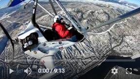
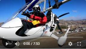
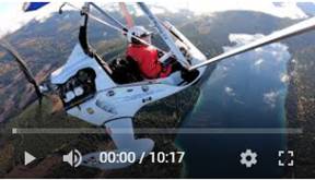
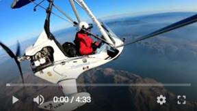
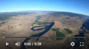
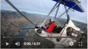
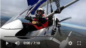
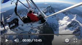
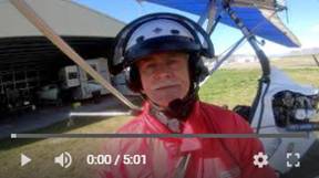
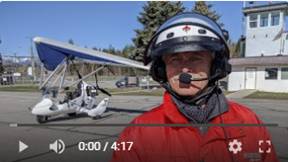
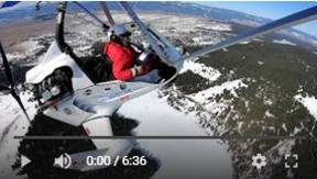
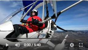
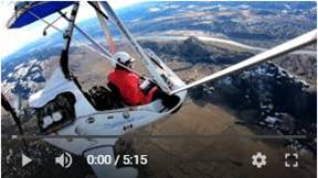
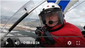
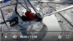
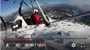
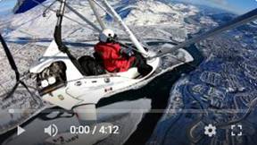 376. Kamloops Winter Beauty, Dec 19, 2021
It was cold, but sunny so it looked very inviting to go flying. We
received some snow, but wind formed many high drifts. I spent more then hour to
shovel my access to runway.
I started at -7C (19F), but ended up at -10C (14F). I found that all my
4 GoPro cameras were off when landed, while batteries showed 100%. This was
serious letdown. Eventually I learned that Hero 7 cameras are good only down to
0C (32F). Previously I had few unintended cameras off at minus 5C, but I
thought it is the usual GoPro quirk. They definitely did not like -10C (14F).
BTW, it is nor written in the manual. I Goggled it. Regardless, I have only half on my flight
which sill shows
Pictures
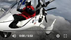
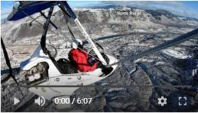
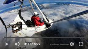
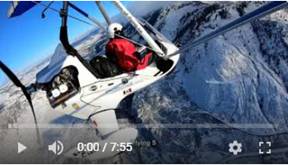 375. Low Level Flight over Kamloops Downtown,
Tobiano and Spectacular North Ridge, Dec 6, 2021
375. Low Level Flight over Kamloops Downtown,
Tobiano and Spectacular North Ridge, Dec 6, 2021
It was perfect flying day at -6C (21F) and some fresh snow. I was lucky
again not to worry about wind nastiness and turbulences, so I could enjoy
closer (then normally) proximity of
Pictures
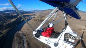
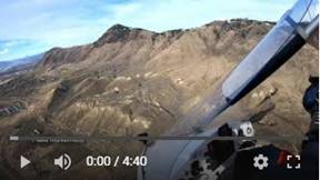
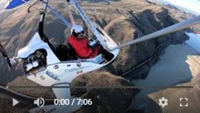
 374. Low Level Flight over Kamloops Downtown, Mt
Peter & Paul and Frederick Road, Dec 3, 2021
374. Low Level Flight over Kamloops Downtown, Mt
Peter & Paul and Frederick Road, Dec 3, 2021
The weather was perfect for low level flying without worrying about
turbulence and wind flow over different hills. I follower Petersen Creek bike
path, then to Mt Peter and Paul to show how big it is on the top. The next
points were low level flights over Mt Mara, Battle Bluffs and surrounding hills
and valleys. Finally I follow the
 373. Low Level
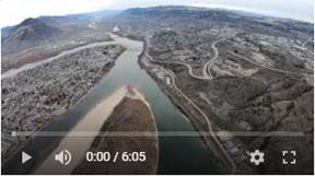
Exploration of Phenomenal Walhachin Area, Nov 26, 2021
373. Low Level
Exploration of Phenomenal Walhachin Area, Nov 26, 2021
The river banks of Walhachin (small village west of
I
made mistake in my video labeling: What I noted there as
Juniper Beach RV Park is in fact the Rock and River Rustic Retreat located in Thompson
Rivers Estates. Juniper Beach is further to the west.
 372. The Best
Time to Fly; First Snow Made Everything Even More Beautiful, Nov 19, 2021
372. The Best
Time to Fly; First Snow Made Everything Even More Beautiful, Nov 19, 2021
I love this time of the year: Fresh snow, blue sky and no wind and
turbulence. The snow really enhances the
 371. Flight
over the most Beautiful Areas in Kamloops, Nov 13, 2021
371. Flight
over the most Beautiful Areas in Kamloops, Nov 13, 2021
It was beautiful flight with some serious turbulence too. I covered
areas in Dufferin,
Pictures
 370. Guided
Tour through Kamloops Area Beauty, Oct 31, 2021
370. Guided
Tour through Kamloops Area Beauty, Oct 31, 2021
I think that this is one of my best videos. Slow and low over North
Ridge popular hiking areas, Lac Du Bois Grasslands Westsyde,
Info Links:
https://www.bcachievement.com/2020/09/29/every-child-matters-the-meaning-behind-orange-shirt-day/
Enjoy relaxing and even upbeat music. Watch
it on large screen for better experience.
 369. Relaxing
Flight over Beautiful Countryside of Knutsford Area, Low Level Downtown and
More, Oct 30, 2021
369. Relaxing
Flight over Beautiful Countryside of Knutsford Area, Low Level Downtown and
More, Oct 30, 2021
Chilly, sunny and no wind morning flight over some of the most beautiful
areas of
 368. Challenging
and Turbulent Adventure Flight around many Kamloops Lakes and Provincial Parks,
Oct 19, 2021
368. Challenging
and Turbulent Adventure Flight around many Kamloops Lakes and Provincial Parks,
Oct 19, 2021
It was fun, but a bit challenging flight. I had to wait till 1 pm for
sky to open and it really did. Still a bit hazy, but happy, sunny day.
I flew through 4 provincial parks and around 14 (annotated) lakes. I
experienced totally relaxing flight in no wind, 55 km/h (34 mph) headwind to 85
km/h (53 mph) tail wind and all this within 15 min. A significant portion of the flight was in
turbulence, but it was not as scary to me as it used to be before.
Half of my flight was above burned out forest section which was
significantly destroyed during 2021 summer Tremont Creek fire. There is a lot
of evidence how the fire progressed to small town
 367. Flying to
Tobiano and Spectacular River Sandbars.
Oct 14, 2021
367. Flying to
Tobiano and Spectacular River Sandbars.
Oct 14, 2021
This was my second flight of the day. The first flight was very
turbulent and so I was hoping for something more relaxing. It started in very
good weather and smooth air up to a point. Eventually it became very turbulent,
just west of Tobiano. In this video, I spent more time in low level flight
above the
 366. Flying
into Very Sudden and Nasty Turbulence.
Oct 14, 2021
366. Flying
into Very Sudden and Nasty Turbulence.
Oct 14, 2021
I found (eventually), that I had cracked and leaking fuel tank. I almost
run out of fuel during my
 365. Short and Sweet Aerial Video from between
Kamloops and Walhachin. Oct 6, 2021
365. Short and Sweet Aerial Video from between
Kamloops and Walhachin. Oct 6, 2021
Short video of
 364. Flying above Beautiful Landscape to Johnson
Lake. Oct 1, 2021
364. Flying above Beautiful Landscape to Johnson
Lake. Oct 1, 2021
We came back from holiday into very beautiful fall weather, big contrast
to smoke ravaged air from the summer forest fires. I flew to
The flight was very relaxing over low cloud/fog in the river valley,
forming spectacular views. The steep hills were filled by fall colors, while
horizon
 363. One of the
Best Days to Fly through 200 km of Kamloops Area Beauty. Sep 2, 2021
363. One of the
Best Days to Fly through 200 km of Kamloops Area Beauty. Sep 2, 2021
We had 1.5 month of terrible forest fires all around BC, poor or no
visibility and serious restrictions where and how to fly. Everything suddenly
changed. Crisp clear, but cold morning provided perfect weather to do some
local exploration. My original plan was to fly to
 362. Flying over Tremont Creek Fire Ravaged Area
(Mt Savona, Tunkwa Lake, Logan Lake…).
Aug 24, 2021
362. Flying over Tremont Creek Fire Ravaged Area
(Mt Savona, Tunkwa Lake, Logan Lake…).
Aug 24, 2021
Interesting birds views of Tremont Creek fire, the east side of burned
out areas. The fire started in July 12, 2021, 27 km west of where I was flying,
burning solid for 2 weeks. I did not use in this video my usual short cuts, but
I kept continual views from my full view front camera.
It is interesting to note that not everything is burned out. The fire is
actually very choosy and the result is patch work of black/brown and green
areas.
I started east of Mt Savona then follow close to
 361. Kamloops in the Middle of Wild Fires from
11, 340 ft. Aug 18, 2021
361. Kamloops in the Middle of Wild Fires from
11, 340 ft. Aug 18, 2021
It looked like nice weather for change, but it did not last very long. I
was planning to fly to Merritt, but right after take off I saw it would be
impossible. The smoke on south site of the city was so thick that the upper
 360. Kamloops, Walhachin, Barnhartvale in Clear
Sky while Surrounded by Wild Fires. Aug
9, 2021
360. Kamloops, Walhachin, Barnhartvale in Clear
Sky while Surrounded by Wild Fires. Aug
9, 2021
Exceptionally nice weather with good visibility, rarity in these days
when
 359. Kamloops
Area is Burning – Extremely Smoky Sky.
Aug 6, 2021
359. Kamloops
Area is Burning – Extremely Smoky Sky.
Aug 6, 2021
I could not wait to get back into the sky. We are here in
The visibility was very poor with two lines above horizon: smoke line at
around 7000’ and very close above it the cloud line. I could not go higher then
8,500’ to have clear view, because the clouds were low. There was certain
beauty in this ugliness and very spooky feeling. The visibility was very bad on
the way back.
 358. My Record
Adventure Flight to 3669 m / 12,004 ft. July 17, 2021
358. My Record
Adventure Flight to 3669 m / 12,004 ft. July 17, 2021
I took off into smoky (forest fires) skies in west direction to check on
developing and existing, out of control fires. Previous day, I visited some
those effected places by motorcycle and now it was the time for the distant
bird view. I had to climb to over 3048 m / 10,000 ft to just clear the smoke
layer to see distant fires. I hit the smoke wall above
 357. Flight in
very Smoky Air. July 14, 2021
357. Flight in
very Smoky Air. July 14, 2021
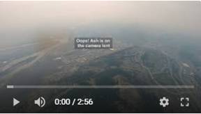
We have 320 wild fires burning in BC. The air was loaded with thick
smoke, which looked worse with the increasing elevation. It was decent when I
left home, but it was changing quickly. I ended up with fire ash covering my
front camera lent.
I wanted to check the latest fires (from distance, of course), but the
west side was like wall of smoke. The east side started to get very turbulent,
when I reached the valley level when the latest fire was burning. I turned around
and cut this flight short. The video still turned out interesting, with rising
sun just slightly poking through like orange ball and layers of smoke of
different colors and shades.
Pictures
 356. Kamloops
Area on Forest Fires. July 6, 2021
356. Kamloops
Area on Forest Fires. July 6, 2021
We have in British Columbia (BC), which is the most western province
(state) in
I had to go up to almost 10,000’ to clear the smoke.
 355. Early
Morning Hot and very Turbulent Flight. June 26, 2021
355. Early
Morning Hot and very Turbulent Flight. June 26, 2021
I took off at 6:30am at 26C, no ground wind and perfectly sunny day. It quickly changed
into 30 km/h headwind and very unpleasant turbulence, which was coming in
serious bursts. I was looking for different elevations, but it was actually
getting warmer with height and more unpredictable higher up. Eventually I did
not want to push my luck and turned back I could feel the hot blast from the
concrete runway during landing. The air temperature was already at 28C
 354. Last Day of Spring, Hot Evening Flight.
June 20, 2021
354. Last Day of Spring, Hot Evening Flight.
June 20, 2021
I took off soaked in my own sweat at 7:45 pm and 28 C (82 F) and almost
cold at 2290 m (7,500’) at 17 C (63 F). It felt at about 1000’ above ground
while coming down like opening oven and walking through it. It was good flight
above our nature beauty which is all aground us here in
 353. Flying to Roche Lake Area, June 17, 2021
Explored new region to me, which is set of lakes around
 352. Checking Flood Situation of our Rivers and
Terrible Turbulence, June 6, 2021
352. Checking Flood Situation of our Rivers and
Terrible Turbulence, June 6, 2021
I started at 6:30 am to avoid thermal turbulence, but it did not help.
Within 5 km the situation changed almost instantly from peaceful to dangerous.
I had to cut short my original plan to check the both
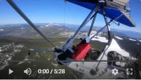
 351. Challenging Flight to Dunn Peak Mountain
Area, May 22, 2021
351. Challenging Flight to Dunn Peak Mountain
Area, May 22, 2021
This was my 2nd flight (https://youtu.be/3pdqw_gorPY)
to the highest mountain peak in this region. The flying conditions here are by
default unpredictable and they change within minutes or few kilometers. I took off
at 6:40 am to beat the sun generated turbulence. The flight started right off
the deck with turbulence getting progressively worse. I was contemplating to
call it off and suddenly everything stopped into very peaceful flight. I flew
up to
The mountain area is spectacular and huge. I spent more time there then
in 2019, to record and absorb all that beauty. How lucky I am to do this! I
wish I could take a busload of people with me to share my experience there. I
was glad when I was back in the river valley, back to civilization. The
mountains are spectacular, but potentially dangerous. The return flight was
peaceful down to Barriere village, then another challenging spot to overcome
through the canyon valley and then turbulence really started. I was flying lice
garbage bag in the wind. There was no return for me; I had to carry though it.
Everything stopped again in about 15 minutes. Landing was another issue when
landing on hot dark runway. I was bounced there very well.
 350. Morning, 128 km Fight in Kamloops Area
Beauty, May 16, 2021
350. Morning, 128 km Fight in Kamloops Area
Beauty, May 16, 2021
I discovered new (to me) lakes, meadows, hills and plains in this
spectacular region, lucky to be living in.
 349. Early Morning Fight Joined by another
Homebuilt, May 11, 2021
349. Early Morning Fight Joined by another
Homebuilt, May 11, 2021
This was different and very unique experience for me. I was joined by
another local pilot in his beautifully built Zodiac homebuilt aircraft. We took
of at 6:30 am to avoid turbulence from the powerful
 348. Beautiful Flight to Sun Peaks and South
Thompson Rive, May 5, 2021
348. Beautiful Flight to Sun Peaks and South
Thompson Rive, May 5, 2021
This early morning flight was very relaxing and enjoyable. I took off early
and 6:30 to beat the powerful sun heat and of course turbulence as shown in my
previous video. This made the trick. My first leg was east, straight into very
low rising sun. I felt like Lindbergh in his Spirit of St. Louis.
I
could see nothing with that sun shining directly into my face through the
windshield and my helmet visor. I had to look sideways to see where I am going.
Everything changed when I turn north towards the
I landed and taxied to my hangar at 8 am and suddenly, like if someone
turn switch on, the wind started to blow but only in the east part of the
airport. The wind sock in the west side was still limped. It was very good flight
 347. Flight in Terrible Turbulence but Beautiful
Weather, May 2, 2021
347. Flight in Terrible Turbulence but Beautiful
Weather, May 2, 2021
My plan ended up totally differently from the original one. I started in
calm, sunny and warm weather, but it changed quickly into very nasty and few
times terrifying turbulences. I was looking into different elevations but no
luck. I made it just 20 km north from the airport, just 1/3 of my planning
distance to
 346. Beautiful, Exciting, Intimidating and
Turbulent Flight to Vidette, Apr 20, 2021
346. Beautiful, Exciting, Intimidating and
Turbulent Flight to Vidette, Apr 20, 2021
I followed
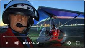 345. Beautiful Sunset Flight in Summer like
Weather, Apr 17, 2021
345. Beautiful Sunset Flight in Summer like
Weather, Apr 17, 2021
I was thinking about this flight long time. I wanted to know how those
navigation lights would look like in darkness. It was exceptionally warm
evening from 24C to 19C and surprisingly no surprises from touchy
 344. Beautiful Flight from Salmon Arm Airport to
Kamloops, Apr 15, 2021
344. Beautiful Flight from Salmon Arm Airport to
Kamloops, Apr 15, 2021
This is return leg of my 223 km cross-country flight, this time from
Salmon Arm back to
 343. Beautiful Flight to Salmon Arm Airport, Apr
15, 2021
343. Beautiful Flight to Salmon Arm Airport, Apr
15, 2021
Very scenic flight following shore of famous and in summer popular
 342. 145 km Flight over Knutsford and Tobiano
Areas, Apr 13, 2021
342. 145 km Flight over Knutsford and Tobiano
Areas, Apr 13, 2021
Very scenic flight over complex terrain and spectacular views. It was
good day.
 341. Flying to Chase, Apr 6, 2021
Very good flight east through South Thompson Rive valley, one of the
most scenic area in
 340. Very
Unpleasant Flight in Pure Turbulence, March 31, 2021
340. Very
Unpleasant Flight in Pure Turbulence, March 31, 2021
After several days of serious winds, this day was totally calm with blue
sky and +8C. I was really looking forward to my cross country flight, but it
was quickly clear that it will not happen. I was bouncing like yoyo as soon as
I took off. I was in one continual turbulence which eventually made me
nauseated. Four days before I flew on commercial flight (as passenger) in heavy
turbulence, which was my second worse turbulence on commercial flight. I become
air sick which I felt for 3 days. My flight only multiplied that sick in
stomach feeling. At least I have very good video from just 30 min flight.
 339. Very Nice Flight to Nicola Valley and
Glimpse Lake, Mar 16, 2021
339. Very Nice Flight to Nicola Valley and
Glimpse Lake, Mar 16, 2021
I took advantage of perfect weather to fly through spectacular BC
countryside.
 338. Flying in
I attempted to fly this valley several times already, but the non
cooperating weather always changed my plans. I was lucky this time. It is very
nice area which I explored on motorcycle from ground up. It was time to do it
from the air. The valley is usually very windy with crazy turbulence, because
the air is compressed into narrow and winding trough. One of my 4 cameras did
not record anything, so I lost one view, but I still have nice video into
classical music.
 337. Flying to Knutsford and North Ridge. Heavy
Turbulence, Mar 2, 2021
337. Flying to Knutsford and North Ridge. Heavy
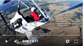
Turbulence, Mar 2, 2021
It was decent day for https://youtu.be/xOV1d5IvHewflying
with no wind at the
 336. Flying form Cache Creek in Exciting Flight,
Feb 21, 2021
336. Flying form Cache Creek in Exciting Flight,
Feb 21, 2021
I was getting anxious to go back after 40 minutes flight from Kamloops.
I did not want the weather change on me. I was already experiencing unpleasant
turbulence when flying in.
I met another ultralight pilot there, Daniel Berwin who landed after me.
He decided to follow me a bit and take some aerial pictures. It was nice
change, because it is just 2nd opportunity in my life to fly with
somebody. Another excitement happened in about 10 minutes in my flight when I
spotted another plane (Cessna) well down under me flying to Cache Creek. He
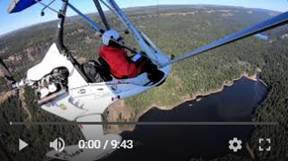
really sucked the air from my track resulting good bump. I started in -2C in
Kamloops landed in +6C in Cache Creek and +8C back in Kamloops. It was very
good and exciting day.
 335. Flying to Tobiano, Walhachin and Cache
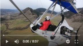
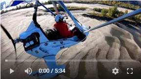
Creek. Good Turbulence, Feb 21, 2021
335. Flying to Tobiano, Walhachin and Cache
Creek. Good Turbulence, Feb 21, 2021
This was the first leg of my 1.5 hour flight to Cache Creek. I flew via
golf and residential area high above Kamloops Lake, Tobiano and down in the
valley on the end of Kamloops Lake, Savona. I continued in the complex valley
of winding South Thompson River creating spectacular scenery. I flew over small
historic village situated high above the river valley, Walhachin. I continued
towards Ashcroft through to deep canyon of South Thompson River, but I felt in
my bones that it would not be smooth sailing. The complex terrain and shifted
winds create unpredictable flying conditions. Eventually, I had enough of
bouncing around and got out before it would be too late. The Cache Creek
Airport and its location are a bit intimidating. First it looks very small from the air
especially when flying from Kamloops with such large airport runway. Secondly
the location in the middle of the mountain slope creates good crosswinds and up
or downdrafts by winds from the perpendicular valley. I met there another
pilot, Daniel Berwin with his Zenair bird. We exchanged few Covid distant words
and experiences. He followed me on my way back and took several pictures from
his ultralight. It was nice.
 334. Beautiful Winter Flight in Beautiful
Wintery Kamloops, Feb 16, 2021
334. Beautiful Winter Flight in Beautiful
Wintery Kamloops, Feb 16, 2021
Finally, after several windy days of real winter in Kamloops, there was
no wind and temperature just below freezing. It was beautiful flight after
morning snow starting to melt on sunny sides. The contrast between the snow and
bare surfaces creates unique enhancement of the Kamloops very complex topography.
 333. Flying in
Fresh Snow to Kamloops Juniper Ridge and Area, Feb 6, 2021
333. Flying in
Fresh Snow to Kamloops Juniper Ridge and Area, Feb 6, 2021
It was gorgeous day after overnight fresh show, blue sky and above
freezing temperature. I took off downwind (~13 km/h) west, turned to east in
totally calm air and in about 200 m higher I got into serious tail wind of up
to 45 km/h from west. The wind was flowing simultaneously from opposite
direction within short elevation difference. I flew over Juniper Ridge
subdivision, which looks very flat from the air, but it is actually very hilly
and assuming also challenging to drive those steep streets in winter. I
explored Rose Hill and Knutsford area too. It was very good flight.
 332. Experience
with “GoPro Hero 9 Black” as a Prime Camera for Unrestricted Frontal View, Feb
2, 2021
332. Experience
with “GoPro Hero 9 Black” as a Prime Camera for Unrestricted Frontal View, Feb
2, 2021
I sold my GoPro Hero 7 and
replaced the front full view camera with the latest GoPro Hero 9 Black. The
reason is Hero 9 horizon lock to prevent horizon tilt when turning. Tilting
horizon is annoying in my videos, so I always switch in those moments to side
camera views. Well, the horizon lock did not work very well and actually it was
very bad. I could use only few clips from this miracle Hero 9 camera. I return
the Hero 9 back to store. Now, I need to buy another Hero 7 Black. I am showing
examples of badness and my interpretation of how this horizon lock would not
work in my case. I was hoping for steady “Super stabilized” views, so I could
run video 4x faster without any distractions. I am sorry to report that the
result was totally unacceptable. This is excellent camera for other
application, but not for what I wanted it for. For that purpose Hero 7 Black is
far superior. If you are considering to buying it for flying then you should
watch this video.
 331. Following
North Ridge to Harper Ski Hill in Heavy Turbulence, Feb 2, 2021
331. Following
North Ridge to Harper Ski Hill in Heavy Turbulence, Feb 2, 2021
I sold my
GoPro Hero 7 and replaced the front full view camera with the latest GoPro Hero
9 Black. The reason is H9 horizon lock to prevent horizon tilt when turning.
This was annoying in my videos, so I always switched at those moments to side
camera views. Well, it did not work very well and actually it was very bad. I
could use only few clips from this miracle camera. I return the Hero 9 back to
store. Now, I wish to buy back my Hero 7 Black camera. I am looking. I will
post me experience and example, why this camera is no good for aviation at
least for full camera view without any part of airplane in the view. It was
expensive experiment for me. I sold my like new camera cheap and most likely I
will pay more and most likely for abused and bruised camera.
It was
beautiful and calm (!) day, but not for long. Within of about 5 minutes it
started kicking up and down. It was getting progressively worse on the way
back. I was looking for some smoother air level, but there was nothing
available for me. When I crossed the N Thompson River west, the peace returned
again. At least I have good video.
 330. Flying over North and South
Thompson Rivers, Jan 29, 2021
330. Flying over North and South
Thompson Rivers, Jan 29, 2021
I have very
good video from cold flight. We had some traces of new snow, which makes the
surrounding scenery more contrasting and more interesting.
 329. Kamloops
Aerial Photos: Peterson Creek, Downtown, North Shore, Brock - Slideshow, Jan
20, 2021
329. Kamloops
Aerial Photos: Peterson Creek, Downtown, North Shore, Brock - Slideshow, Jan
20, 2021
Pictures
taken from the top (south) of Peterson Creek in small increments through
downtown then west up to airport. Pictures are from video # 327
 328. Beautiful
Nicola Valley Aerial Photos - Slideshow, Jan 20, 2021
328. Beautiful
Nicola Valley Aerial Photos - Slideshow, Jan 20, 2021
Pictures
taken only in
 327. Low
Flight through the most Beautiful Valley in Kamloops Region, Jan 20, 2021
327. Low
Flight through the most Beautiful Valley in Kamloops Region, Jan 20, 2021
It was an
excellent, but a bit chilly flying day. I tried several times before to fly low
in the Nicola Valley, but it was always very drafty a of course unpredictable.
I was lucky this time. This is one of the most scenic roads in BC and
especially on motorcycle. It looks so peaceful from the road, but it is totally
different from the air due to the complex terrain causing unpredictable winds
and wind flows. I have very good video from one hour flight at 90 to 140 km/h ground
speed.
 326. Cloud
Challenge to Keep within Clear Sky, Jan 15, 2021
326. Cloud
Challenge to Keep within Clear Sky, Jan 15, 2021
The airport
area was without clouds when I took off. As soon as I was above their level I
could see that it would be wise to stay within that hole only. The clouds
eventually cleared on the west side and open up also south. I flew over Ajax
mine, Tobiano and sandbars. The flying conditions were very interesting. I
could see just peaks of the Kamloops landmarks poking through to cotton balls.
It was warmer by 5C just under the clouds then by the river. The ground was
calm, but 40 km/h wind at 5000’.
 325. Following South Ridge to
Buse Hill and North Ridge to Sandbars. Turbulent Air, Jan 15, 2021
325. Following South Ridge to
Buse Hill and North Ridge to Sandbars. Turbulent Air, Jan 15, 2021
Finally
after 16 days of warm, but very windy weather, the Mother Nature finally
brought crispy, blue sky and no wind day. Masses of people enjoyed this sudden
change together with several local flyers. I was planning to go for low and
close aerial exploration of Buse Hill which looks very cool on its north side.
I soon discovered that I would be lucky if I even make it there. The air was
very bumpy with many very sudden kicks and pushes, which took a bit of optimism
from my joy. I made it there, but I did not dare to go any close to it. The
flight on the way back was not any better. I saw 9 wild horses on at the foot
of North Ridge. I finished my flight with a victory lap over the river delta
sand bars. They are amazing creation of nature, which could be seen only from
the above, high just enough to see the underwater formations. When I landed I
found out that my full view, front mounted camera refused to record. Those
cameras are not very reliable. It was very good day anyway.
 324. CBC Radio Interview with Me,
Jan 7, 2021
324. CBC Radio Interview with Me,
Jan 7, 2021
This is
radio interview with me about my flying in Kamloops. I turned it into a slide show
to make it more enjoyable to watch. It was very good and I am happy how it
turned out.