YouTube Flying Videos by Jan
Nademlejnsky
>> HOME <<
January 5, 2026
| 2026 | 2025 |
2024 | 2023 | 2022 | 2021 | 2020 | 2019 | 2018 | 2017 | 2016 | 2015 | 2014 | 2013 | 2012 | 1974-2010 | Video Index |
You could search this page by
pressing Crl F
| BC Fires | My Tubespace |
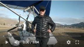
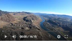
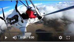
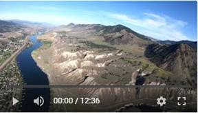
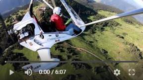
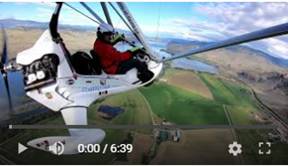
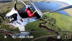
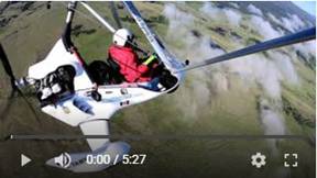
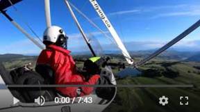
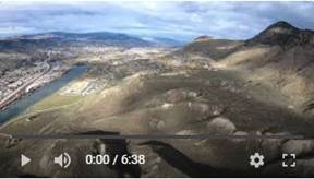
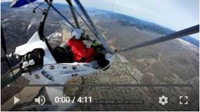
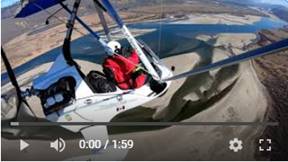
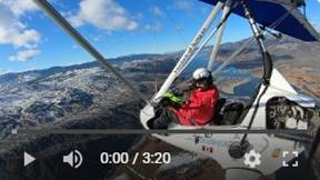
 323. The Last Flight of Decade, Low Level over
Downtown and North Shore, Dec 31, 2020
323. The Last Flight of Decade, Low Level over
Downtown and North Shore, Dec 31, 2020
Very good
video from the low level flight over the
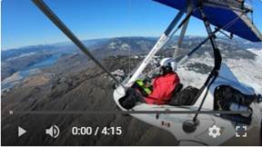
 322. Flying to Savona-Deadman Rd Area via North
Ridge and Tobiano, Dec 27, 2020
322. Flying to Savona-Deadman Rd Area via North
Ridge and Tobiano, Dec 27, 2020
Another
decent day to fly, with temperature just hovering around freezing, but sunny west
of the airport. This is what I selected to fly; following the sun. The mountain
views of the N-W Ridge are spectacular. The snow and bare area create pencil
like drawings with so much details filling every pixel. It was beautiful. I flew above many
eagles on
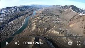
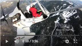
 321. Flying to Harper Mt Ski Area
by South Thompson River, Dec 27, 2020
321. Flying to Harper Mt Ski Area
by South Thompson River, Dec 27, 2020
It was
beautiful, sunny day to fly over just 2 day old snow covered terrain. This
valley is the most picturesque area in the
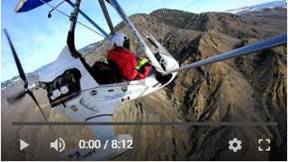
Finally, we
had good flying weather with temperature a touch above zero. I was following
TransCanada hwy #1 to Tobiano. This very winding road is carved through very
nice hills and valleys while passing through the upper
Pictures
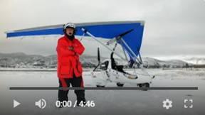
 319. What to Wear in Cold Weather, Nov 28, 2020
Several
people posted on Facebook
question about what to wear in winter while flying open aircraft. This short
video shows what I wear and what works. I used to fly down to -25C (-13F), so I
feel to be qualified to show what works.
 318. Low level flight over
Knutsford area and North Thompson River, Nov 28, 2020
318. Low level flight over
Knutsford area and North Thompson River, Nov 28, 2020
I wanted to
fly over 7 peaks south of the Campbell Creek. Unfortunately, very low cloud
ceiling forced me to turn around and look for some better conditions. I flew
north up to McLure, very low to get better view of my surroundings. Weather was
excellent and flight very enjoyable.
The video looks very good and I hope that at least people living in those areas
would like it. Just after take of I felt me knees getting cold and realized
that I forgot to put on my snowmobile (winter) pants. I flew 1.5 hours and I
was a bit stiff, but not too bad. This trike is reasonably “warm”. I flew 1.5
hours at average ground speed of 121 km/h. That’s very good!
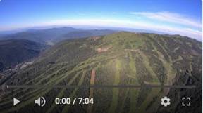
 317. Flying to Sun Peaks to Check the Ski Season
Opening Day, Nov 21, 2020
317. Flying to Sun Peaks to Check the Ski Season
Opening Day, Nov 21, 2020
Sun Peaks
Resort is the second largest ski resort in
 316.
Flying above Kamloops Rivers, Nov 19,
2020
316.
Flying above Kamloops Rivers, Nov 19,
2020
It was another
beautiful day to go exploring the
Pictures
 315. Flying in Quickly Changing Clouds Ceiling,
Nov 10, 2020
315. Flying in Quickly Changing Clouds Ceiling,
Nov 10, 2020
We received
real winter like snow, but sun started to peek through the clouds. I have to
clear snow to get to the runway first, while blue sky was quickly shrinking.
Traces of sun were replaced with white clouds pushing downwards and squeezing
me out like a tooth paste. I was forced to turn around to just legal limit to
avoid those clouds. I still have good video from around the downtown.
Pictures
 314. Very Few People have Seen Kamloops Beauty
from This Angle, Nov 6, 2020
314. Very Few People have Seen Kamloops Beauty
from This Angle, Nov 6, 2020
I changed
editing concept in this video and I think I will stick with it. I am using 4
GoPro cameras, which run continually. Previously I cut views in 5 sec clips,
while cuts were synchronized with the music beat. My intent was to show all
views, front, both sides and pilots view. Now, I run the front camera with full
170 deg horizontal view at 2x speed with minimum cuts. I use the other cameras
views only in turns, because the front view does not look good because of the
panning effect and horizon tilt.
The weather
was exceptional with perfect
It would be
nice if you leave me your comment, and tell me what you think about my video
editing change.
Note: I have LG TV with 3D feature (3D
glasses). I tried to turn TV on 3D and the view was amazing. I was very, very
impressed. How is it done, to convert it instantly into fake 3D, without 3D
cameras?
 313. Glory, Optical Effect, During my Flight,
Oct 31, 2020
313. Glory, Optical Effect, During my Flight,
Oct 31, 2020
Wikipedia: A glory is an optical phenomenon, resembling an iconic saint's halo
around the shadow of the observer's head, caused by sunlight or (more rarely)
moonlight interacting with the tiny water droplets that compose mist or clouds.
The glory consists of one or more concentric, successively dimmer rings, each of
which is red on the outside and bluish towards the centre. Due to its
appearance, the phenomenon is sometimes mistaken for a circular rainbow, but
the latter has a much larger diameter and is caused by different physical
processes.
Glories arise due to wave
interference of light internally refracted within small droplets.
 312. Beautiful
Flight along North and South Ridges, Oct 20, 2020.
312. Beautiful
Flight along North and South Ridges, Oct 20, 2020.
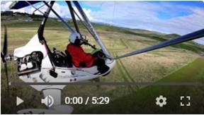
After unexpected cold snap down to -11C, it was another
beautiful day for flying. It is still pleasant to fly at +6C temperature and
especially in my “warm” Apollo trike. The Apollo cockpit is very well
designed to protect me from the element. It is big difference when compared
with my previous AirBorne “cold” trike.
I
followed North Ridge west, crossed
 311. Flying
with Spectacular Kamloops Clouds, Oct 20, 2020.
311. Flying
with Spectacular Kamloops Clouds, Oct 20, 2020.
Late morning with -3C temperature and many different layers
of clouds were too inviting to ignore. It was one of the most spectacular
flights for me. I am so lucky to have almost 360 deg no obscured view from my
trike so see that vast area beauty. I have never seen this type of clouds at
the second cloud layer. You cannot see that from the ground, I felt like to
jump into them and have some serious fun there. It was very good flight.
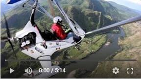
 310. Flying
to Tobiano and Mt Savona in the Best Scenery Ever, Oct 14, 2020.
310. Flying
to Tobiano and Mt Savona in the Best Scenery Ever, Oct 14, 2020.
It was one of my best flights ever. If you want to watch this
video then do yourself favor and watch it on a large monitor or at least on a
tablet. The phone screen is too small to really appreciate our natural beauty
in
All my cameras worked perfectly and the sun and clouds were
in right places to capture the nature at its best. I was a bit sidetracked to
check potential forest fire on western horizon. I made low passes over the edge
of Mt Savona Provincial Park with spectacular rocky cliffs and top covered with
the first autumn snow. You can see very, very long train snaking along the edge
of
Pictures
 309. Flying above Clouds to Ajax Mine and Tobiano,
Oct 11, 2020.
309. Flying above Clouds to Ajax Mine and Tobiano,
Oct 11, 2020.
Chilly morning at 3C, but sunny day brought smile to my face.
I could fly and enjoy to Covid free time above
Pictures
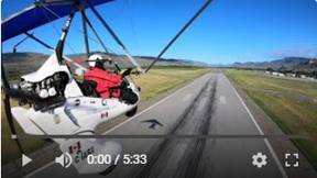
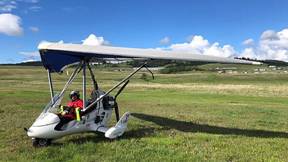
 308. My
First flight after 2 Month Wait for New Prop Blade, Oct 6, 2020.
308. My
First flight after 2 Month Wait for New Prop Blade, Oct 6, 2020.
This was my first flight after the August unfortunate mistake
(see Video # 306), which ruined 2
months of my flying days. I also changed this time the prop pitch from 9 to10
degrees. I set it correctly on the ground (when I bought this trike) to prevent
potential engine over revving, but I found that in flight it would run about
500 extra RMP. My cruise speed now increased about 5 kn (10 km/h) at 5000 RPM,
but I have to push the throttle harder. I think my fuel consumption will go up.
I will see the next time during at least one hour flight.
It was short, just local flight, because the sky was still
very smoky from the West coast
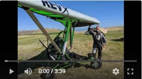 307. Dean with his New Rev X Trike, Aug 15,
2020.
307. Dean with his New Rev X Trike, Aug 15,
2020.
I
came to see in real life the famous
Pictures
 306. This is how I Ruined my Flying Days, Aug 2,
2020.
306. This is how I Ruined my Flying Days, Aug 2,
2020.
It was ideal weather for flying, but I wished I stayed at home.
Just a few seconds after take off I felt like a wing cable broke off. Engine
started to vibrate. Landed immediately and taxied back to my hangar where I saw
what happened. One bar mitts was on the ground. I removed my winter bar mitts,
because it was already 25C and put them on my rear seat bag. The mitts are very
florescent bright, so they are difficult to miss, but I did. I forgot them
behind my back.
I checked for damage and there was just about ¼” of prop
blade edge protection tape slightly damage. Checked the prop pitch values and
the affected pitch was 1 deg off. I figured I got off very easy this time. I
set up the pitch, started the engine and the vibration was the same. Now what?
Hopefully it is not the engine. Eventually I found that the blade was cracked
just on the edge of the blade hub. I was very lucky to be above the runway when
this happened.
 305. Pritchard
to Kamloops Full Screen Aerial View, July 28, 2020.
305. Pritchard
to Kamloops Full Screen Aerial View, July 28, 2020.
This is just section from flight as per video # 303. It is unedited, full
screen view from just front camera. The best is to watch it on large screen or
TV to appreciate the natural beauty of that region in
 304. Sun
Peaks Full Screen Aerial View, July 28, 2020.
304. Sun
Peaks Full Screen Aerial View, July 28, 2020.
This is just section from flight as per video # 303. It is unedited, full
screen view of
Pictures
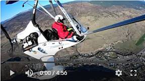
 303. Flying to Sun Peaks and Chase Village, July 28, 2020.
My first really warm flying, because it was already 19C at 7
am. It was even 19 C at 2334 m (7625’). The sky was very hazy which looked even
worse while flying against the raising sun. I made several passes over the
 302. Flying Savona,
Tunkwa Lake, Face Lake, Chuwhels Mt, Knutsford, July 20, 2020.
302. Flying Savona,
Tunkwa Lake, Face Lake, Chuwhels Mt, Knutsford, July 20, 2020.
This was my 3rd attempt to do the above loop.
Finally sky was clear and conditions just right. It was very pleasant and
relaxing trip. I am just showing snippets from this 136 km long flight, over
very spectacular countryside. The terrain is very divers and complex. It is
always pleasure to look around from the eagle perspective.
 301. Flying to
Barriere BC and Back over North Thompson River, July 17, 2020.
301. Flying to
Barriere BC and Back over North Thompson River, July 17, 2020.
155 km long trip to small town Barriere about 60 km north of
 300. Flying to
Harper Ranch via Cold Creek with some Clouds to Enjoy, July 13, 2020.
300. Flying to
Harper Ranch via Cold Creek with some Clouds to Enjoy, July 13, 2020.
I was anxious to try my new drag chute camera. I tried it the
previous day, but the view angle was disappointing. I made new camera bracket
which did its work. I was also anxious, because potential negative effect on
flying characteristic. The camera is attached to “badminton style” basket and
pulled on string attached to one side of the wing. This causes unsymmetrical
directional force, resulting, as one pilot described, difficult to control in
straight direction. I did not find any problems.
My plan was to fly to
 299. Flying to Kamloops Downtown, Knutsford and
Dew Point Areas. Heavy Turbulence, July 12, 2020.
299. Flying to Kamloops Downtown, Knutsford and
Dew Point Areas. Heavy Turbulence, July 12, 2020.
Typical
Pictures
 298.
Checking
Flooded South Thompson River in Kamloops, July 5, 2020.
298.
Checking
Flooded South Thompson River in Kamloops, July 5, 2020.
I flew about 1500’ feel above ground to see the effect to the
river flood. I started about 6 km east of
 297.
Flying to
Tobiano, Savona and Tunkwa Lake with Nice Clouds, July 5, 2020.
297.
Flying to
Tobiano, Savona and Tunkwa Lake with Nice Clouds, July 5, 2020.
Beautiful day to be in the open air. It was still on colder
side at 11 to 12C around 8 am, but sky was blue and eventually I met some
fluffy clouds to enjoy. I had to change my original plan due to heavy and very
intimidating cloud in front of me. It was very peaceful flight.
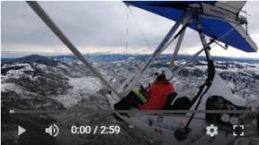
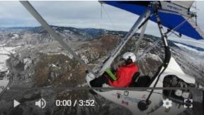
 296.
Flying to
Savona in Turbulent and Hazy Air, July 3, 2020.
296.
Flying to
Savona in Turbulent and Hazy Air, July 3, 2020.
My original plan was to fly triangular cross-country, but the
poor flying conditions changed my plan. I completed just one side of the
triangle and decided to fly back. It started as beautiful and sunny morning,
but the sky changed to overcast and very hazy before I got ready. I expected no
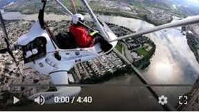
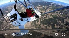
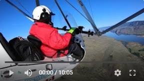
turbulence, because thermal changes were very small. I was wrong. My trip
turned few times and instantly from peaceful to nasty rides. I cut it short,
because I did not want to push my luck.
I have still very good video with very good background music
which will lift your feet in its rhythm.
 295.
Flying
across Nicola Valley to Douglas Lake, June 18, 2020.
295.
Flying
across Nicola Valley to Douglas Lake, June 18, 2020.
170 km (106 mi) flight over beautiful area of rolling hills, deep
valleys, many lakes and exceptionally green terrain. It is interesting how
green it was. We are living in very dry climate, where everything is normally
brown, except spring and early summer. It is amazing how the nature is rushing
though its life to push itself to display all its beauty in very short period.
My goal was to check the
 294. South Thompson River Flooding Part 2 of 2,
June 3, 2020.
294. South Thompson River Flooding Part 2 of 2,
June 3, 2020.
This is unedited and complete aerial view from front camera
only. It starts at 17 km east of
Pictures
 293. North Thompson River Flooding Part 1 of 2,
June 3, 2020.
293. North Thompson River Flooding Part 1 of 2,
June 3, 2020.
This is unedited and complete aerial view from front camera
only. It starts at 28 km north of
Pictures
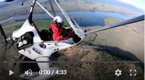
 292. Survey of North and South Thompson River
Flooding, June 3, 2020.
292. Survey of North and South Thompson River
Flooding, June 3, 2020.
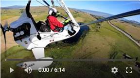
Both
Pictures
 291. Fun with Clouds in Nicola Valley, May 27,
2020.
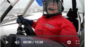
291. Fun with Clouds in Nicola Valley, May 27,
2020.
Beautiful flight, https://youtu.be/LoLslqEodxgsouth
of
Spectacular
Pictures
 290. Flying along North Ridge and Flooded
Tranquille Farm, May 24, 2020.
290. Flying along North Ridge and Flooded
Tranquille Farm, May 24, 2020.
I had totally different plan where to fly, but sudden
and unexpected turbulence put dumper into my expectation. It started peacefully
when flying east until I crossed the
Pictures
 289. Flying to Knutsford, Ajax and Flooded
Tranquille Farm, May 19, 2020.
289. Flying to Knutsford, Ajax and Flooded
Tranquille Farm, May 19, 2020.
I decided that it is just about time to land on our grassy
landing strip in Knutsford. I was very hesitant to do it, because the terrain
is very bumpy and landing is up or downhill. This is very fast trike with
landing speed of 90 km/h. I could land in much worse areas in the case of
emergency, but this was not emergency and I didn’t want to create one.
Regardless, I did it and I was glad. I met there another
trike pilot from
I flew over the
 288. My Trike in the Air, May 19, 2020.
When circling our flying club airstrip, I noticed another
trike on the ground. I could not believe it. So far I was here just lonely
ultralight flyer. That’s very good. New member who kindly took the pictures and
video. I have tons of pictures and videos, but nothing of me from ground up. I
was really impressed how fast this trike really is. It does not feel too fast
when flying it.
Pictures
 287. Flight from Kamloops to Brigade Lake, May
14, 2020.
287. Flight from Kamloops to Brigade Lake, May
14, 2020.
A day before I explored very beautiful Knutsford area on my
motorcycle. I decided to check it out also from the above too. I was not
disappointed. No matted what you do, you cannot find boring areas around
Pictures
 286. Flight from Merritt to Kamloops, May 8,
2020.
286. Flight from Merritt to Kamloops, May 8,
2020.
This is return trip of my previous video # 285. While I was
cruising up to 145 km/h flying to Merritt, I could not reach even 100 km/h of
ground speed when flying back. I took direction of the famous “
Those “patches” are much warmer then surrounding green
forests, creating serious turbulence. It was bumpy and occasionally unpleasant.
 285. Flight from
Kamloops to Merritt BC, May 8, 2020.
285. Flight from
Kamloops to Merritt BC, May 8, 2020.
It was very nice flight in one of those times which don’t
happen very often. Warm day with blue sky and no wind. I decided to fly to
Merritt following one of the most scenic roads in the
 284. Flight from
Kamloops to Cache Creek, May 1, 2020.
284. Flight from
Kamloops to Cache Creek, May 1, 2020.
Beautiful, early morning, 140 km long flight through
Pictures
 283. Flight from Buse
Hill to Kamloops, Uncut Version. Apr 19, 2020.
283. Flight from Buse
Hill to Kamloops, Uncut Version. Apr 19, 2020.
It is always the most difficult and time consuming process to
edit my flying videos into short version for human consumption. The problem is
that
I also learn with my #273
video, that there are people with interest in nature and beauty presented to
them in very rare and unique views which few people could experience. That
video is my most popular flying video so far and it is long. The new GoPro
camera technology (Hero 7) solved the most annoying problems of vibration and
jello effect. Hero 7 camera has perfect stabilization producing spectacular HD
and wide angle videos. One of my cameras is mounted on the front of the trike
showing nothing but the beauty as I fly through it. That technology also allows
me to speed up this video 2.5 to 3x so more information is presented in shorter
time. Aerial videos are not easy to produce, because the perception of speed is
diminishing with the elevation above the ground. Basically, it looks more
boring higher I fly.
I am showing in this video flight in west direction, when the
sun was behind or on my left side, exactly what I needed for good exposure. Sky
was fully seeded with fluffy clouds casting spotty shadows over the hills and
valleys. You could see there some spectacular views from about 1000’ above ground.
You could appreciate the complexity of the terrain when you look around the
screen. It was very good flight.
 282. Flight to Buse
Hill, Apr 19, 2020.
282. Flight to Buse
Hill, Apr 19, 2020.
It was beautiful day to fly over
Pictures
 281. How to Set up SPOT to be Ready in Emergency
with only the Last Track.
281. How to Set up SPOT to be Ready in Emergency
with only the Last Track.
1. The company lost the original intent of SPOT, which is to
call for help and find where you are. It is not to keep tracks of your trips,
because GPS is far better for this purpose. 2. It uses confusing name Asset
instead Device. It is device and it is very clear what device means. Asset will
not make it better, just confusion. I thought that asset was set of points
until SPOT agent told me that it is device. 3. Delete button and date filter
were removed form the main screen. It is totally illogical to burry it deep in
menus. I would never find it there without Company help. There is no manual or
tutorial. 4. Current delete button, if lucky to find it, deletes everything.
The date filter should be put back. 5. “Check in” button brings out tons of
useless info and takes you to a useless place. I use SPOT for flying, the same
like many other people I know. We all agree that the latest update is very bad
and impossible to use. Many people are talking to switch to other devices. We
are all 65 to 85 years old and many of my colleagues are scared of computers.
The message delivers frightening presentation and especially when received on
phone. The fonts are microscopic and impossible to read. Your default link
arrives as a text of 3 lines with unreadable micro text. Did you try to select
your 3 line link on phone and the paste it to address bar? 6. I and majority of
my fellow pilots use the SPOT 7. I go flying, have to do some work there,
waiting for weather until the good time to go. Before take off I press Check
in. My message is sent to my wife to start to look after me just in case
something goes wrong. She is not very computer skilled, but she is above
average computer user. There is no way she could navigate though SPOT presented
info which is buried somewhere in weird named menus. She is somewhere out and
see the info only on the phone. She cannot see anything because it is unusable
on the phone. She needs to see whole map and only map showing the current
flight points and preferably with the last known point flashing. The actual
coordinates could be read by clicking the point. After landing I press OK again
to let her know I made it safely. 8. I found that https://maps.findmespot.com/s/K36V/4R
is the perfect. This link or some other to produce the same result is needed.
It is very clear and it should be always default. Everything else to be
optional. Currently you get tons of info but the most important substance must
be painfully discovered. 9. What is alert and what is its purpose? Check in,
Help, SOS… are already alerts. Why do we need duplication? 10. The logging
button within the map is also messed up. First, it says log out, but it means
both. To log in it suggests my email, which is not my ID. As soon as I start
type in first character then Password changes to Manage. I have to enter
password first and then user ID. That’s amateurish!
 280. Kamloops from 10,000’ above Airport, Apr 9,
2020
280. Kamloops from 10,000’ above Airport, Apr 9,
2020
Due to
Covid-19 pandemic, I decided to fly just around the airport without my usual
exploration flights. I could return safely back to airport without the engine
power. To make it more interesting I set a goal to go up to 10,000’ (3 048m)
above airport. I made it to 11,600’ (3 536m) above sea level. Obviously, higher
up above ground the perception of speed disappears. You feel like suspended
motionless in the air with spectacular 360 deg view. It was very pleasant
feeling. My views are especially special, because I am not looking through
glass or through small windows. There is nothing between me and the
environment. The ground temperature was 12C (54 F) and 3C (37 F) on the top,
which is very good. No more frozen fingers.
Pictures
 279.
Short Flight with Fuel Problem, Apr 6,
2020
279.
Short Flight with Fuel Problem, Apr 6,
2020
I originally promised that I will not
fly during the Covid-19 pandemic. I did not want to push my luck. I knew that there
would be very limited medical help just in case I would need it, plus very high
potential to get infected by that virus. It would be certainly fatal in my age.
Lately,
we finally have very beautiful days, ideal for flying. I could not take it
anymore. I decided to fly only at gliding distance from the airport to mitigate
any dangers. I could make it back safely with dead engine. My goal today was to
show how this areal looks from 10,000’ above ground. I wanted to spiral in very
wide oval into 12,000’ and then idle down back to airport. It was very ironic,
because just half way up, at 5,700’ I noticed low fuel pressure. I was not very
trilled about it. I looked that my flying will be over, plus the find what the
problem is. I turn on an auxiliary fuel pump which increased the fuel pressure,
but it was still not normal. Lowered RPM, pump on/off, RPM up… nothing worked,
while trike engine did not complain a bit. I called tower with my changed plan
due to low fuel pressure. I was asked if I need emergency stand-by, like fire
truck and ambulance. I was fine with just bid inconvenience. Eventually I found
that it was fuel filter. I never ever had any fuel pressure gauge in my
previous trikes and ultralight and I never had any fuel problem. It is a bid
disappointing with this trike, because it has only 80 hours total. I think I
would be really stressed to be far away from the airport.
Pictures
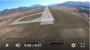 278.
Unnoticed Flock of Geese in my Landing Area,
March 20, 2020
278.
Unnoticed Flock of Geese in my Landing Area,
March 20, 2020
I noticed
a shadow from a bird flying overhead just before a touch down. I never notice any birds (usually geese), so
that shadow surprised me. After reviewing the videos from the on board cameras,
I saw around 50 Canadian Geese in area where I was touching down. Any collision
with those big birds could potentially create serious damage to any aircraft.
 277.
Kamloops to Cache Creek Area, March 20,
2020
277.
Kamloops to Cache Creek Area, March 20,
2020
Really
spring weather with 6 to 8C, but of course, that take off and landing
turbulence again on sun heated concrete runway. The turbulence was
discouraging, but eventually it was very nice flight. It was also first flight
after many months without frozen fingers. This area west of the
Pictures
 276. Kamloops to Campbell Rd Valley, March 17,
2020
276. Kamloops to Campbell Rd Valley, March 17,
2020
The
weather looked perfect, with blue sky, warm air, but still cold in shadows.
There must be turbulence. I was not “disappointed”. It started to kick me up
and down right out of deck. Turbulence was just short live and it was very
peaceful flight the next 40 minutes. I went to 6,500’ to 7,500’ where the air
was smooth. I received another few kicks just north of airport on the way back.
I was not
looking forward for my landing. I experienced very similar conditions during my
previous flight and it was nasty just few feet above the runway. I expected the
same this time, and it came. The air was very still with wind sock pointing
down, which was bad sign. The air will not be agitated. The warm and cold air
blocks were side by side waiting for something to disturb their temporary
equilibrium. Sometimes just a bird flying through could cause the major air
movement. I was that bird. I started dancing above runway. I could feel on my
face blasts of warm air from left and right blowing under my helmet face
shield. I increased my landing speed and I was hoping for the best. The actual
touch down was very good, but I was going up and down just few feet above the
asphalt.
Again, it
was very relaxing flight. This was my social isolation from COVID-19 virus
epidemic emergency but mainly from all that bad and depressing news.
Pictures
 275. Nothing but Turbulence, March 9, 2020
Two
minutes of turbulent flying. It shows unusual, not perfect, but very well
recovered landing: Push rather then pull after first bounce.
Pictures
 274.
Short, but Turbulent Flight in Noon
Heating. March 9, 2020
274.
Short, but Turbulent Flight in Noon
Heating. March 9, 2020
It was one
of those rare days with blue sky, no wind, warm, but still cold in shade
(-2C). I knew that it will be bumpy
without any wind to agitate the cold and warm air. I was surprised that the
turbulence started right during the take off. I was considering to go home
during the next 5 min. Eventually, it smoothed out, at least for a while. I
climbed up to 6,500’ looking for good flying conditions. I had several more
kicks during my flight above this beautiful terrain.
I was not
looking forward to landing, because of hot runway right beside cold river and
warm beaches. This is never too good here in
Pictures
 273.
Low Level Flying by North Ridge. Long
Version from just Front Camera, March 1, 2020
273.
Low Level Flying by North Ridge. Long
Version from just Front Camera, March 1, 2020
This is very little edited version of the
previous video # 272. I used just
front camera video running 2x faster. The perceived flying speed is between 200
and 250 km/h above fascinating and very complex terrain. I did it to show the
real
Pictures 1 Pictures 2
 272.
Low Level Flying by North Ridge, March
1, 2020
272.
Low Level Flying by North Ridge, March
1, 2020
Favourable flying conditions allowed me to fly
much closer then lately to the ground, so I could show the full range of the
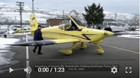 271.
Squadron of Vernon RV Homebuilts
Visiting Kamloops Flying Club
271.
Squadron of Vernon RV Homebuilts
Visiting Kamloops Flying Club
It was unusual sight in the sky and on the
ground to see and hear five, high performance RV homebuilts. They joined our Kamloops Flying Club for
regular Tuesday coffee and donuts social gathering and pilot talk.
Pictures
 270.
Good Flight to Harper Mountain and River
Valley, Feb 24, 2020
270.
Good Flight to Harper Mountain and River
Valley, Feb 24, 2020
I was planning to fly to
 269.
Flying Kamloops, Showing Just Turbulence
Section, Feb 15, 2020
269.
Flying Kamloops, Showing Just Turbulence
Section, Feb 15, 2020
This
video, version 2, is edited so that only sections with turbulence are shown.
It looked
like peaceful day for flying, but the reality was just opposite. As soon as I
crossed
Pictures
 268.
Flying Turbulent Kamloops North Ridge,
Feb 15, 2020
268.
Flying Turbulent Kamloops North Ridge,
Feb 15, 2020
It looked
like peaceful day for flying, but the reality was just opposite. As soon as I
crossed
I was also testing another GoPro Hero 7 Black (3rd one), but the result was extremely disappointing. The stabilization did not work for some unexplained reason. The footage was practically useless and much worse then from my previous Hero 3 camera. Hero 8/B has Super stabilization, but it was horrendous in this case.
Pictures
 267.
Flying to Savona and Downtown Kamloops,
Jan 27, 2020
267.
Flying to Savona and Downtown Kamloops,
Jan 27, 2020
It was
beautiful, spring-like day, but flying conditions were not too relaxing. I
encountered a lot of turbulence. I tried different altitudes, over water,
terrain with and without snow, but no luck. It really built a lot of anxiety
when not knowing if this is how it will be or is it just warm up for the big
one. I was already in several serious turbulences before, so I am not looking
forward to experience it again. Eventually the air was much friendlier over the
downtown to pleasure me down. Overall, it was good flight.
Pictures
 266. Kamloops from the above Clouds, Jan 22,
2020
266. Kamloops from the above Clouds, Jan 22,
2020
The
morning started very promising with sun, +5C, but forecast called for windy day.
I waited till about 10 am, but there was no wind. I took my chances and I did
not regret it. It was one of my most relaxing and beautiful flight. I was
planning to cross
 265.
Kamloops Winter Beauty from the Air, Jan
9, 2020
265.
Kamloops Winter Beauty from the Air, Jan
9, 2020
It was very good flight, but my fingers were getting numb which determined the flight duration. It is not easy to take pictures and fiddle in knobs in heavy gloves.